
The USACE Wetlands Delineation Manual provides standardized procedures for identifying and delineating wetlands, evolving from agency-specific guidance established before 1986.
Historical Context of Wetland Delineation Guidance
Prior to 1986, federal wetlands programs lacked unified guidance, relying on individual agency approaches to wetland identification. This resulted in inconsistencies and challenges in regulatory application. The emergence of the 1987 Delineation Manual marked a pivotal shift, establishing a common framework for federal agencies.
Early efforts focused on defining wetlands based on three key parameters: vegetation, soil, and hydrology. Subsequent revisions, driven by legal challenges and scientific advancements, refined these criteria. Technical manuals became crucial for agency-wide consistency, addressing the need for standardized procedures. The evolution reflects a growing understanding of wetland ecosystems and the importance of accurate delineation for regulatory compliance and conservation efforts.
Purpose and Scope of the Manual
The USACE Wetlands Delineation Manual serves as the primary guidance document for identifying and delineating wetlands under Section 404 of the Clean Water Act. Its core purpose is to establish a consistent, repeatable methodology for determining a wetland’s boundaries.
The manual’s scope encompasses a wide range of wetland types, providing detailed procedures for assessing vegetation, soils, and hydrology. It applies to projects requiring Department of the Army permits impacting waters of the United States, including wetlands. This ensures regulatory clarity and supports informed decision-making regarding wetland protection and mitigation.
Key Components of the Delineation Process
The delineation process involves preliminary data review, site reconnaissance, detailed vegetation assessment, soil analysis, and hydrology evaluation, utilizing a three-parameter approach.
Section 1: Preliminary Information
Initiating a wetland delineation requires thorough preparation, beginning with comprehensive data gathering and review. This crucial first step involves collecting existing information such as National Wetland Inventory (NWI) maps, Soil Survey data, topographic maps, and aerial photographs. Understanding the project area’s history, including prior disturbances and land use, is also essential.
Reviewing this preliminary data helps to identify potential wetland areas and informs the scope of the subsequent field investigation. It allows the delineator to anticipate potential challenges and focus efforts efficiently, ultimately contributing to a more accurate and defensible delineation. Careful planning at this stage saves time and resources later in the process.
Data Gathering and Review
Effective wetland delineation hinges on meticulous data gathering and review. This phase necessitates acquiring resources like National Wetland Inventory maps, detailed Soil Survey information, USGS topographic maps, and high-resolution aerial imagery. Historical maps and records revealing past land use and alterations are also vital.
Analyzing these datasets helps predict potential wetland locations and guides field reconnaissance. Identifying potential concerns, such as prior excavations or drainage features, allows for focused investigation. Thorough review ensures the delineator understands the site’s context, leading to a more informed and accurate assessment of wetland characteristics.
Section 2: Site Reconnaissance
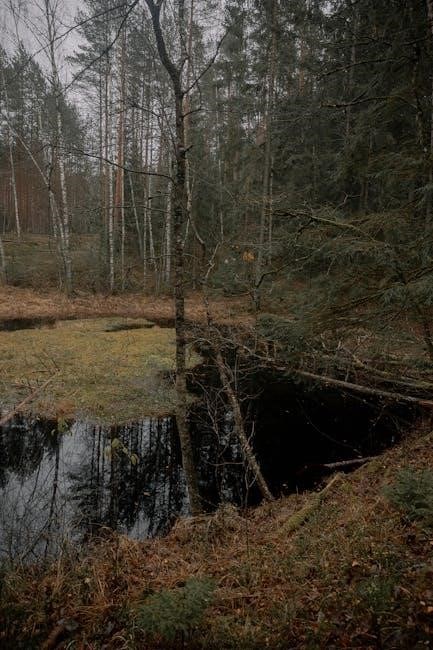
Site reconnaissance is a crucial initial field step, building upon preliminary data. This involves a general walk-through of the project area to visually identify potential wetland areas based on landscape position, vegetation, and any observable hydrologic features. Look for evidence of prolonged saturation, such as watermarks or drainage patterns.
Document initial observations, noting variations in plant communities and soil types. This broad overview helps refine the sampling strategy for subsequent, more detailed investigations, ensuring efficient allocation of resources and a focused approach to wetland identification.
Identifying Potential Wetland Areas
Identifying potential wetland areas during site reconnaissance relies on observing landscape features indicative of wet conditions. Focus on areas with hydrophytic vegetation – plants adapted to saturated soils. Look for evidence of periodic flooding, such as sediment deposits or altered vegetation patterns. Low-lying areas, depressions, and areas adjacent to streams or lakes are prime candidates.
Pay attention to soil coloration; dark soils often suggest prolonged saturation. Document these observations with field notes and photographs, creating a preliminary map of areas warranting further investigation during the detailed delineation process.
Section 3: Vegetation Assessment
Vegetation assessment is a crucial component of wetland delineation, focusing on plant communities. The process involves identifying and documenting the dominant plant species within a sample plot. Determining if these species are hydrophytic – adapted to wet environments – is key. This relies on utilizing regional hydrophytic vegetation lists and indicator status for each species.
Assess the overall plant community structure, noting the prevalence of hydrophytes. The presence of dominant hydrophytic vegetation strongly suggests wetland conditions, contributing significantly to the three-parameter approach.
Dominant Plant Species Identification
Identifying dominant plant species requires careful observation and taxonomic expertise within the delineated area. This involves determining which plant species are most abundant or have the greatest coverage within representative sample plots. Accurate species identification is paramount, utilizing field guides, keys, and potentially expert consultation.
Dominance isn’t solely based on percentage cover; it also considers the species’ overall contribution to the community structure. Documenting the scientific names, common names, and estimated percent cover of each dominant species is essential for a comprehensive vegetation assessment.
Hydrophytic Vegetation Indicators
Hydrophytic vegetation indicators are crucial for determining if a plant community is adapted for life in wetlands. The USACE Manual utilizes a list of plant species, categorized by their affinity for wetland environments – obligate, facultative-wetland, facultative, facultative-dry, and upland.
Assessing hydrophytic vegetation involves calculating a prevalence index based on the wetland indicator status of dominant species. A prevalence index below a certain threshold signifies hydrophytic vegetation, supporting a wetland determination. Proper application of these indicators requires understanding species ecology and regional variations.

Soil Characteristics and Analysis
Soil analysis focuses on identifying hydric soil indicators – physical, chemical, and biological features developed due to prolonged saturation, vital for delineation.
Hydric Soil Indicators
Hydric soil indicators, as defined by the USACE, are crucial for wetland identification, revealing prolonged saturation. These indicators encompass various features, including redoximorphic features – colors and concentrations resulting from iron and manganese transformations under fluctuating wet/dry conditions.
Other indicators involve organic matter accumulation, histel sapristic layers, and specific morphological characteristics. Field observations, coupled with laboratory analyses, help determine if soils exhibit these properties. Accurate identification relies on understanding the relationship between soil formation processes and wetland hydrology, ultimately supporting reliable wetland delineations.
Soil Sampling and Testing Procedures
Soil sampling for wetland delineation requires careful technique, documenting soil horizons and color using Munsell charts. Samples are collected at representative locations within the potential wetland area, typically to a depth of 50cm or until encountering non-hydric material.
Testing procedures include assessing redoximorphic features, organic matter content, and pH levels. Laboratory analyses may involve determining iron and manganese concentrations. These data, combined with field observations, help determine if hydric soil indicators are present, supporting a wetland determination according to USACE guidelines.

Hydrology Assessment
Hydrology assessment focuses on identifying evidence of water presence, including indicators like flooding, saturation, and watermarks, crucial for determining wetland characteristics.
Identifying Wetland Hydrology Indicators
Identifying wetland hydrology indicators is a critical step, involving observation of physical evidence demonstrating prolonged soil saturation. These indicators encompass various features, including watermarks, sediment deposits, drainage patterns, and oxidized rhizospheres. Assessing water sources and flow patterns is also essential, determining if they contribute to wetland conditions.
Evidence of periodic flooding or saturation, like hydrogen sulfide odors or shallow water tables, further supports a hydrological connection. The USACE manual details specific indicators, guiding field personnel in accurately assessing the presence and duration of wetland hydrology, ultimately informing the delineation process. Careful documentation of these observations is paramount.
Water Source and Flow Patterns
Analyzing water source and flow patterns is crucial for understanding wetland hydrology. Identifying the origins of water – precipitation, surface runoff, groundwater – reveals how wetlands are supplied. Observing flow paths, including sheet flow, channel flow, and groundwater discharge, demonstrates water movement within and around the potential wetland area.
Determining if these sources contribute to prolonged saturation is key. The USACE manual emphasizes documenting these patterns, noting any alterations from natural conditions. Understanding these dynamics helps determine if the observed hydrology meets the criteria for a wetland, supporting the overall delineation assessment and report conclusions.
Evidence of Periodic Flooding or Saturation
Documenting evidence of periodic flooding or saturation is paramount in wetland delineation. Indicators include watermarks, sediment deposits, drainage patterns, and stressed or stunted vegetation. Observing these features demonstrates the extent and duration of water presence. The USACE manual requires detailed observations and recording of these signs, providing objective support for a hydrology determination.
Analyzing soil characteristics alongside these indicators strengthens the assessment. Evidence must demonstrate that the area experiences sufficient inundation or saturation to influence plant and soil development, ultimately confirming wetland hydrology as a key parameter.
The Three-Parameter Approach
The three-parameter approach, central to the USACE manual, integrates vegetation, soil, and hydrology to determine wetland presence, requiring all three for confirmation.
Vegetation, Soil, and Hydrology Interplay
The USACE manual emphasizes that wetland identification isn’t solely based on one indicator; rather, it’s the interconnectedness of vegetation, soil, and hydrology. Hydric soils develop under prolonged saturation, influencing plant communities adapted to those conditions.
Dominant plant species, termed hydrophytes, demonstrate adaptations to wet environments. These plants, coupled with the presence of hydric soil indicators and evidence of wetland hydrology – like flooding or saturation – collectively define a wetland.
Absence of any one parameter doesn’t automatically disqualify an area, but a comprehensive assessment of all three is crucial for accurate delineation, adhering to the manual’s core principles;
Applying the Three-Parameter Approach in the Field
In practical application, delineators systematically assess each parameter at representative sites within the potential wetland area. Vegetation analysis involves identifying dominant species and determining their hydrophytic status using established indicator lists. Soil examination focuses on identifying hydric soil indicators – characteristics formed under prolonged saturation.
Hydrology assessment requires documenting evidence of water presence, such as visible watermarks, saturation, or drainage patterns.
Data collected for each parameter is then evaluated collectively; a wetland is generally identified when all three parameters are positively indicated, supporting a conclusive determination in the field.

Documentation and Reporting
Accurate records are crucial, necessitating completion of the Delineation Data Sheet and compilation into a comprehensive report detailing findings and methodologies.
Completing the Delineation Data Sheet
The Delineation Data Sheet serves as the primary record of observations made during the wetland delineation process. It meticulously documents site-specific information, including geographic coordinates, vegetation composition, soil profiles, and hydrological indicators. Each parameter – vegetation, soils, and hydrology – requires detailed entries, referencing observed characteristics and utilizing established indicator lists.
Accurate completion is paramount, ensuring consistency and defensibility of the delineation. The sheet captures dominant plant species, hydric soil evidence, and indicators of wetland hydrology. Proper documentation supports regulatory decisions and provides a clear audit trail for future reference or verification. Thoroughness and adherence to the manual’s guidelines are essential for a reliable assessment.
Creating a Wetland Delineation Report
The Wetland Delineation Report comprehensively summarizes the entire delineation process and its findings. It builds upon the completed Data Sheets, presenting a narrative description of the site, methodology, and conclusions. The report must clearly articulate how the three-parameter approach – vegetation, soils, and hydrology – was applied and how wetland boundaries were determined.
Detailed maps illustrating the delineated wetland boundaries are crucial, alongside supporting documentation like photographs and data logs. The report should address any ambiguities or challenges encountered during the process, ensuring transparency and defensibility; A well-prepared report facilitates regulatory review and supports informed decision-making regarding wetland protection.

Coordination with Ordnance Safety (USACE Operations)
Wetland delineations on USACE lands require coordination with Ordnance Safety, particularly when potential explosive ordnance disposal (EOD) concerns exist during field activities.
Addressing Potential Explosive Ordnance Disposal (EOD) Concerns
Prior to commencing any wetland delineation work on USACE properties, a thorough assessment of potential explosive ordnance (UXO) hazards is crucial. Historical land use, particularly former military training areas, significantly increases the risk. Coordination with the USACE Ordnance Safety office is paramount to determine if a preliminary site assessment or UXO sweep is necessary.
Delineation teams must receive appropriate safety briefings and understand procedures for recognizing and avoiding potential UXO. If any suspect items are discovered, work must cease immediately, and the Ordnance Safety office contacted. Detailed documentation of any UXO finds, including location and description, is essential for reporting and subsequent remediation efforts. Safety protocols are non-negotiable.
Safety Protocols During Delineation Activities
Wetland delineation often involves traversing challenging terrain and potential hazards. All personnel must wear appropriate personal protective equipment (PPE), including sturdy boots, long pants, and high-visibility vests. Awareness of local wildlife, including venomous snakes and insects, is critical, and appropriate precautions should be taken.
Teams should maintain clear communication protocols, utilizing radios or other devices, and implement a buddy system. First-aid training is essential, and a well-stocked first-aid kit must be readily available. Prior to entering a site, a safety briefing outlining potential hazards and emergency procedures is mandatory. Adherence to these protocols minimizes risks and ensures team well-being.

Recent Updates and Revisions to the Manual
The manual undergoes periodic revisions to reflect changes in regulatory definitions and incorporate new scientific findings regarding wetland identification and assessment.
Changes in Regulatory Definitions
Regulatory definitions of wetlands have experienced notable shifts over time, necessitating corresponding updates to the USACE Wetlands Delineation Manual. These changes often stem from Supreme Court decisions impacting the scope of “waters of the United States,” directly influencing jurisdictional wetland boundaries. Revisions address evolving interpretations of terms like “adjacent” and “significant nexus,” clarifying how wetlands connect to traditionally navigable waters.
The manual’s updates ensure consistency in applying these revised definitions across various districts and projects. Staying current with these legal and regulatory modifications is crucial for accurate wetland delineation and compliance with federal regulations, preventing potential legal challenges and ensuring effective environmental protection.

Incorporation of New Scientific Findings
The USACE Wetlands Delineation Manual continually integrates the latest scientific advancements in wetland ecology, hydrology, and soil science. Updates reflect improved understanding of hydrophytic vegetation, hydric soil formation processes, and wetland hydrological regimes. New research on wetland functions and values informs refined delineation criteria, enhancing the accuracy and reliability of assessments.
This incorporation ensures the manual remains aligned with current scientific knowledge, addressing emerging challenges like climate change impacts on wetland ecosystems. Utilizing these findings leads to more ecologically sound decisions regarding wetland protection and management, supporting long-term sustainability.

Resources and Tools for Wetland Delineation
Ecobot and similar software simplify wetland assessments, while comprehensive technical manuals and agency guidance from the USACE support accurate delineations.
Ecobot and Similar Software
Ecobot emerges as a valuable asset for environmental consultants, streamlining the often-complex processes of wetland, stream, and Ordinary High Water Mark (OHWM) assessments. This software offers a free subscription plan, providing accessibility to essential delineation tools. Beyond Ecobot, various digital solutions are available, aiming to enhance efficiency and data management during field work.
These tools often incorporate GPS integration, digital data forms, and automated report generation, reducing manual effort and minimizing potential errors. While software assists in organization, a thorough understanding of the USACE Wetlands Delineation Manual’s principles remains crucial for accurate and legally defensible wetland determinations.
Technical Manuals and Agency Guidance
Technical manuals offering agency-wide guidance on wetland delineation represent a relatively recent development within federal wetlands programs. Prior to 1986, no unified federal guidance existed, leading to inconsistencies across agencies with regulatory authority. The USACE Wetlands Delineation Manual, and subsequent updates, aimed to standardize the process.
Alongside the Manual, various agencies – including the EPA and state environmental departments – provide supplementary guidance and resources. Staying current with these evolving regulations and best practices is essential for professionals conducting wetland delineations, ensuring compliance and accurate assessments.